Current Time in Page, AZ
(MST)
October 30, 2026
Vermilion Cliffs National Monument: Visitor Guide
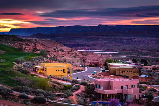
Vermilion Cliffs National Monument covers about 280,000 acres of cliffs, canyons, and sandstone along the Arizona and Utah line, west of Page. It holds some of the most famous rock formations in the Southwest, including The Wave and White Pocket, and it is one of the places where endangered California condors fly free. It is also undeveloped: there are no paved roads inside the monument and no visitor centers, so how much you see depends on your vehicle, your permits, and your planning.
Here is how the monument fits together, what you can see from the highway, and where the famous spots are.
Vermilion Cliffs National Monument at a glance
| Established | November 9, 2000 |
| Size | About 280,000 acres, from 3,100 to 7,100 feet in elevation |
| Neighbors | Glen Canyon National Recreation Area to the east, Kaibab National Forest to the west |
| Roads | No paved roads inside. House Rock Valley Road is maintained dirt; most other roads need high-clearance four-wheel drive |
| Permits | Required for The Wave, Coyote Buttes South, and overnight trips in Paria Canyon |
| Services | None. No visitor centers, gas, or water inside the monument |
| Managed by | BLM Arizona Strip Field Office, (435) 688-3200 |
What is in the monument
- The Vermilion Cliffs themselves, a long red escarpment that rises above Highway 89A between Marble Canyon and Jacob Lake.
- The Paria Plateau, the high, sandy tableland above the cliffs, home to White Pocket.
- Coyote Buttes, the cross-bedded sandstone of The Wave in Coyote Buttes North and the formations of Coyote Buttes South, both permit-only.
- Paria Canyon, part of the Paria Canyon-Vermilion Cliffs Wilderness, a three- to five-day backpacking trip that needs an overnight permit.
What you can see without a four-wheel-drive vehicle
You do not need a permit or a four-wheel-drive vehicle to enjoy the monument. Two experiences are easy to reach:
- Highway 89A along the cliffs. West of Navajo Bridge and Lees Ferry, the paved highway runs along the foot of the Vermilion Cliffs, with the red wall on one side and open desert on the other. It is a beautiful drive, especially in late afternoon light.
- The Condor Viewing Site. About 3 miles up House Rock Valley Road from Highway 89A, the BLM keeps a viewing area with an information kiosk, a shade structure, and a restroom. The Peregrine Fund and the BLM have released captive-bred California condors from the cliffs here since 1996. Bring binoculars and scan the cliff face, and remember that the birds also roost on Navajo Bridge.
House Rock Valley Road is a maintained dirt road, but it can become impassable when wet, so check the weather before you turn off the pavement.
The famous spots
- The Wave: the most famous formation in the monument, limited to 64 people a day through advance and daily lotteries.
- White Pocket: swirled sandstone with no permit lottery, reached by deep sand roads that require high-clearance four-wheel drive or a guided tour.
- Coyote Buttes South: quieter formations with their own advance lottery on Recreation.gov, and a sandy, four-wheel-drive approach.
- Paria Canyon: a multi-day backpacking route through a deep canyon, with permits required for overnight trips and real flash flood risk.
Getting there from Page
Page is a natural base for the monument, with two ways in:
- The south side: take US Highway 89 south, turn west onto US Highway 89A at Bitter Springs, and cross the Colorado River at Navajo Bridge. Past Marble Canyon, the highway follows the cliffs west toward Jacob Lake. The south end of House Rock Valley Road meets Highway 89A 13.5 miles east of Jacob Lake.
- The north side: take US Highway 89 west for 36 miles to the north end of House Rock Valley Road, the route to White Pocket and the trailhead for The Wave.
In dry weather, House Rock Valley Road links the two highways, which makes a full-day loop possible from Page. Part of the north side crosses into Utah, so from March to early November your phone may jump an hour ahead. See our Page time zone guide.
Staying safe in the monument
The BLM lists the hazards plainly: rugged and unmarked roads, deep sand, flash floods, extreme heat and cold, and venomous reptiles and insects. A few habits go a long way:
- Fill your gas tank before leaving the highway, and carry plenty of water and food.
- Carry a full-size spare tire, not a compact one.
- Expect little or no cell service, so download maps before you go and tell someone your plans.
- Stay out of canyons and washes when storms are possible anywhere upstream.
There are no visitor centers in the monument. Arizona Strip visitor maps are available at the BLM's Paria Contact Station on US Highway 89, the BLM visitor center in Kanab, and online.
Camping
Dispersed camping is allowed outside the wilderness area in places that have already been disturbed, such as existing campsites. Two developed BLM campgrounds, Stateline and White House, sit just outside the monument. Pack out everything you bring in.
Pairing it with Antelope Canyon
The monument deserves at least a full day, so plan it around your canyon tour rather than on the same morning. A good rhythm from Page:
- Day one: a Lower Antelope Canyon tour and Horseshoe Bend.
- Day two: the south side of the monument: Navajo Bridge, Lees Ferry, Highway 89A along the cliffs, and the Condor Viewing Site.
- Day three, if you have permits or a tour: The Wave or White Pocket.
For somewhere to stay, see hotels near Antelope Canyon, and for more nearby ideas, the Toadstool Hoodoos and things to do in Page. When your dates are set, book your Lower Antelope Canyon tour.
We Think You'll Like These
Read More of Dixie

Subscribe to Our Newsletter
Stay connected to the canyon. Get stories, updates, and insider tips delivered to your inbox.